• Skip to primary navigation
  • Skip to main content
Featured Project: large, engineered log-jam structures to stabilise actively eroding streambank
catchment-solutions-logo
catchment-solutions-logo-white
Search
  • Home
  • About
    • Vision, Capabilities & Values
    • Our board
    • Our team
    • Positions vacant
  • Services
    • Water Quality Services
    • Agricultural Innovation and Support
    • Fisheries & Aquatic Ecosystems
    • Environmental Planning & Approvals
    • Ecosystem Rehabilitation & Repair
  • Projects
    • Featured Projects
    • Agricultural Innovation and Support
    • Ecosystem Rehabilitation & Repair Projects
    • Environmental Planning & Approvals
    • Fisheries & Aquatic Ecosystems
    • Water Quality Services
    • Archived Projects
  • News
  • Media
  • Contact
Project enquiry
Hide Search

Catchment Solutions

Ogmore Erosion Remediation Project

diana · Sep 23, 2019 ·

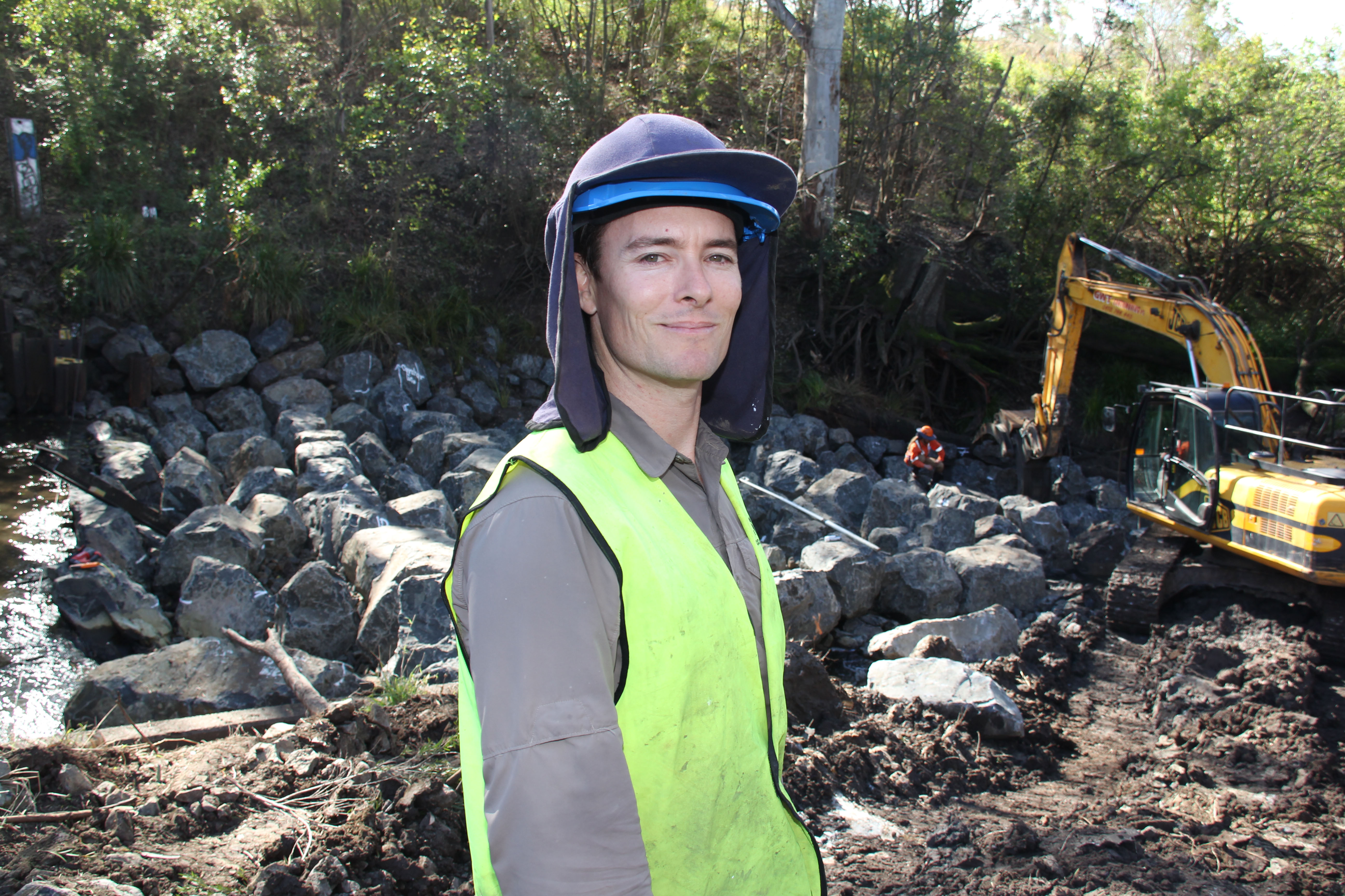
In early 2019, Catchment Solutions commenced a project aimed at addressing severe erosion in the Ogmore area of the Styx River catchment, funded through Reef Trust IV. Due to the sodic nature of the soil found within the Styx River Catchment, even with restricted grazing, active gully erosion is occurring at a significant rate. Paddock to Reef modelling has demonstrated that the Ogmore area contributes 26,880t of fine sediment to the Great Barrier Marine Park per year.
Severe erosion at Ogmore.
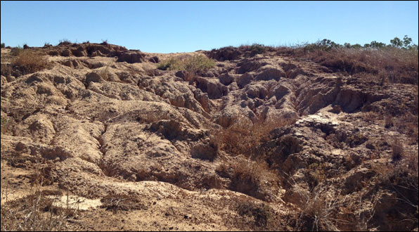
Figure 1. Severe erosion representative of the catchment land issues throughout the Ogmore region.
To minimise ongoing erosion, six demonstration trial plots are to be set up at the Oakdean Station, to assess and demonstrate various erosion remediation methods intended for future adoption of these methods throughout the broader Ogmore area. Erosion treatment methods to be trialled include combinations of gully reshaping, ripping (shallow <200mm), gypsum treatment (10t/ha), lime treatment and (2t/ha) and rhodes grass seed application (10kg/ha). Additionally, following any earthworks, mulching by Conservation Volunteers Australia will be undertaken to reduce rainfall impacts on the rehabilitated gully areas.

On completion of the project, the demonstration site will be used to hold remediation workshops to local landholders within the Ogmore area, providing for expansion of the treatments to other similar sites owned by neighbouring landholders within the catchment.

On-ground trial works of the project are anticipated to commence in October/ November 2019.

Ogmore remediation project.

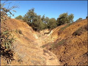
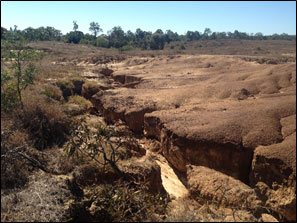
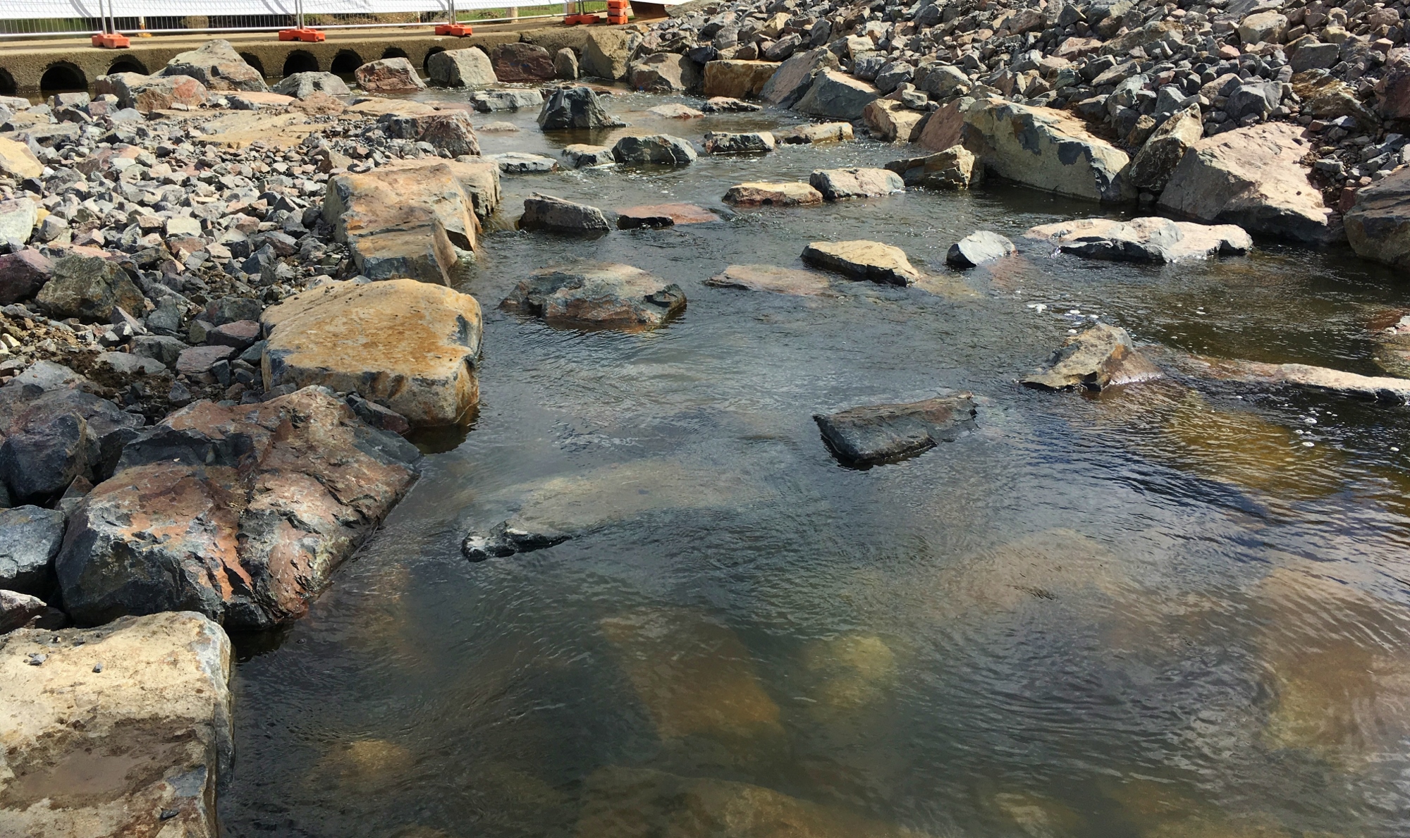
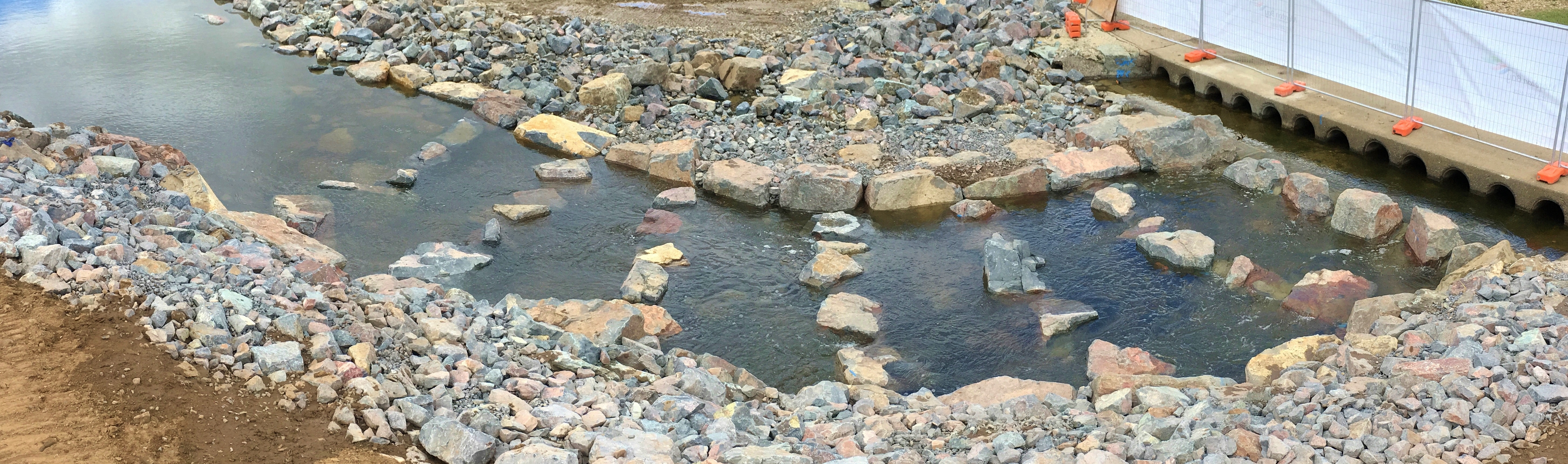
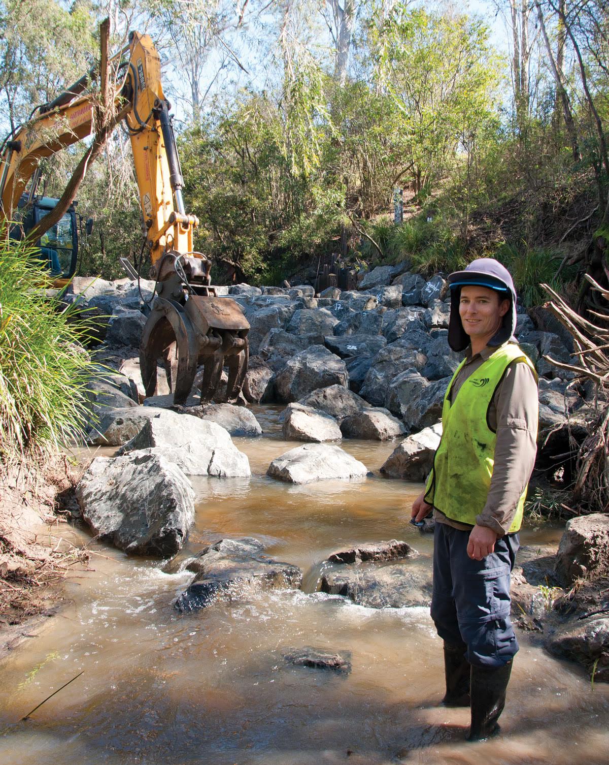
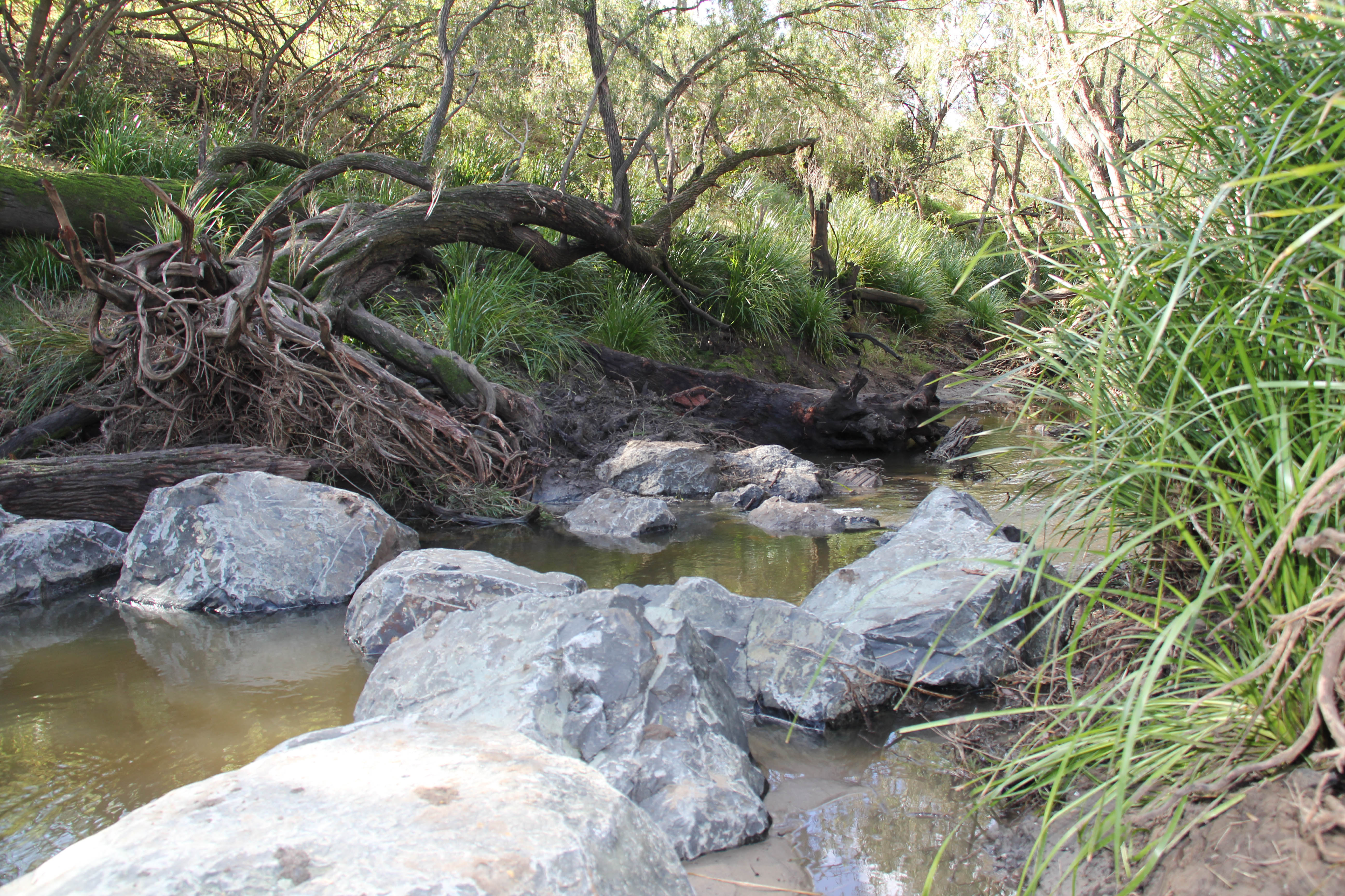
Figure 2. Additional gully erosion images from throughout Ogmore, where remediation trials will commence in late 2019.

Remediation of Leitchs Crossing complete

diana · Sep 25, 2018 ·

The remediation of Leitchs Crossing with a nature-like rock-ramp fishway was undertaken in partnership between Moreton Bay Regional Council and Catchment Solutions. Leitchs Crossing is located in the lower reaches of the South Pine River and was ranked as the 11th highest priority fish barrier in the greater Brisbane region. A fish passage options assessment determined that a full width rock-ramp fishway was the best fish passage remediation option for this barrier type in assisting fish to ascend past the barrier to upstream habitats.

Figure 1. Leitchs Crossing fish barrier prior to the remediation with a rock-ramp fishway.
Figure 2. Images of fish barrier during construction of the Leitchs Crossing rock-ramp fishway.

Following construction of the rock-ramp fishway at Leitchs Crossing, fishway monitoring was carried out in October 2017 to assess the capabilities of the fishway at passing the full suite of fish species and size classes expected to occur in South Pine River. The fishway trap was set at the exit of the fishway on the upstream side of the crossing, to show the numbers and species of fish that were able to ascend the fishway. Across five days of monitoring, a total of 19 species were surveyed ascending the fishway at an overall rate of 1,195.9 fish per day. Notable captures include juvenile freshwater mullet and speckled goby, both diadromous fish species that had not previously been recorded during annual EHMP fish surveys in the South Pine River (survey site located upstream of the former barrier). It is anticipated that improved connectivity as a result of the fishway will assist in the recovery of freshwater mullet and speckled goby populations in the South Pine River. Also significant was the high numbers of juvenile sea mullet; SEQ’s most important commercial inshore net fishery species, recorded at a catch rate of 209 fish per day. Similar to all fishway monitoring sites, no wild Australian bass were recorded, potentially suggesting poor and/or failed recruitment of this species.

Table 1. Catch results of fishway monitoring of the Leitchs Crossing fishway in October 2017.

Figure 3. Fish captured successfully ascending Leitchs Crossing fishway during fishway utilisation monitoring.

Fish Passage Rehabilitation in South East Queensland

diana · Sep 12, 2018 ·

For the past three years, Catchment Solutions has been part of a project that identified more than 13 000 barriers to fish passage in South East Queensland, across 14 catchments. These movement barriers include weirs, culverts, bridge crossings, walkways, roads and tidal bunds.

Barriers were prioritised in order to develop potential remediation options that would allow fish to complete their migratory life-cycles, often between estuarine and freshwater environments. A number of sites were then selected for remediation to have fish ladders or ‘fishways’ designed and constructed as part of the project to demonstrate the effectiveness of these types of structures. This video highlights the fishways and the monitoring that occurred following remediation works with outstanding results in fish passage rehabilitation.

This project was co-funded by local councils and Reef Catchments NRM through the Australian Government’s National Landcare Program. Fishway design and construction was delivered by Catchment Solutions. This video was produced by Kim Kleidon, edited by Jac Kotze.

Jungle perch stretch their fins in Brendale

diana · May 30, 2017 ·

Catchment Solutions and Moreton Bay Regional Council have completed a nature like rock ramp fish ladder at Leitch’s Crossing on the South Pine River which allows economically valuable juvenile fish to move freely upstream.

Catchments Solutions fisheries biologist, Matt Moore, said the native fish were really poor swimmers and could only swim fast in small bursts which meant road crossings, causeways, weirs and culverts were major barriers.

South Pine River and a rock ramp fishway.
South Pine River rock ramp fishway.

The velocity through the pipes, and the drop of downstream at Leitch’s Crossing, prevented critical life-cycle dependant migrations upstream for decades which impacted on native fish populations.

“We’ve opened up breeding habitat for Jungle Perch and Australian Bass, both of which are popular with recreational fishers,” said Matt.

Councillor Mike Charlton said the new fishway, located on the border between Brendale and Albany Creek, was similar to a set of stairs and allowed fish to easily make their way up and down the peak of an existing culvert one step at a time.

Fish ladder at South Pine River.
South Pine River rock ramp fishway, facing upstream.

More than 400 tonne of rocks, weighing as much as 3.5 tonne each were strategically placed with a large excavator to form a series of pools interspersed with small 70 mm drops.

Catchment Solutions has completed three out of the planned five fish-ways to re-connect fish habitats
fragmented by barriers in South-east Queensland. These five were identified as the most important to need remediation out of 13,797 barriers in the region.

South Pine River rock ramp fishway.
South Pine River rock ramp Fishway, Leitchs Crossing in Brendale, Qld

The South Pine River fish ladder is a joint project between Moreton Bay Regional Council and Reef Catchments with co-funding from the Australian Government National Landcare Programme (Target Area Grant). The design and construction of the Fish Ladder on Leitchs Crossing in Brendale was overseen by environmental consultants Catchment Solutions.

Queensland’s longest fish ladder at Ipswich

diana · Aug 23, 2016 ·

Matt Moore from Catchment Solutions in Mackay on a riverbed with rocks.
Photo credit: John Armstrong, Lifestyle Qld

August 3 saw the construction of Queensland’s longest ‘fish ladder’ in Ipswich.

Over 80 metres long, 2.4 metres high and with 35 steps and pools – once completed the ladder will give important native fish species easy access to their upstream homes for the first time in more than fifty years.

The project sees Ipswich City Council leading the charge in improving fish population and waterway health in South East Queensland.

The structure is being delivered in tandem with environmental consultants and fish ecology specialists, Catchment Solutions, alongside Reef Catchments and Stanwell Corporation Limited.

Rock ladder.“This is a huge step up, so to speak, for our native fish in the Bremer river area. There are numerous fish ladders in Queensland but none as long as 80 metres,” said Matt Moore, fisheries biologist with Catchment Solutions in Mackay.

“Fish populations upstream of Berry’s Weir have declined significantly due to restricted fish passage and movement through the water since the weir was built in the 60s. For example, we know while you can catch Australian Bass downstream below the weir, people have stopped catching them upstream.”

The weir is 2.4 metres high posing an insurmountable challenge for all juvenile and adult native fish, particularly diadromous (migratory) species, which need to swim upstream from the sea to freshwater habitats to complete their lifecycle, before returning as fully grown adults to spawn.

“It’s a rite of passage for fish and without this full cycle, what we will see is significantly reduced populations of important recreational and commercial native fish species like Australian bass, sea mullet and long and short-finned eels. That’s a problem for waterway health, fish diversity, and recreational fishing,” Mr Moore said.
“What the ladder does is provide a series of steps and pools in a natural rock formation that allow the fish to easily ascend over the barrier (in this case the weir) by swimming, stopping for a rest, and swimming again.”

Matt Moore at the Bremer River rock way.Ipswich Mayor Paul Pisasale said council was committed to helping improve local waterways.

“The challenges we face today in improving our local waterways did not come about overnight, and as such it will take several years to meet them,” he said.

“Council is committed to balancing environmental needs alongside our city’s on-going growth and making sure sustainability is front and centre for all that we do.

“This fish ladder is an important piece of infrastructure that will directly improve conditions for fish in the Bremer River and is a part of council’s strategy of focusing heavily on actions that will directly improve waterway health.”

Mr Moore said the Bremer River had been identified in a recent report as one of the key priority areas for removal of fish barriers.

“Report findings identified over 13,000 potential barriers to fish passage in the South East Queensland area. Berry’s Weir in the Bremer River was listed in the top ten target fish barrier sites, coming in at number seven as one of the most important sites to improve fish passage.

“I’d like to extend a huge congratulations to Ipswich City Council for recognising and investing in the restoration of fish passage to improve waterway and aquatic ecosystem health.
“Likewise, works could not have gone ahead with the support and cooperation of Stanwell, which own the weir, and have played an integral part in this process. This is an excellent example of true collaboration and the sustainability outcomes that can be achieved.”

It is hoped the fish ladder will also help improve the Bremer Catchment’s overall waterway health score, which was listed as a D- in the latest Healthy Waterways Report Card.


Mackay Whitsundays Fishways Monitoring Results (2016)

diana · May 10, 2016 ·

Recent fishway monitoring across the 2015/16 wet season has revealed some interesting results with a high abundance and diversity of juvenile fish species recorded successfully ascending the regions fishways (Figure 1). Fishway trap monitoring was undertaken on Lagoons and Fursden creeks within the Pioneer River Catchment (Mackay) and on Boundary and Tedlands creeks in the Rocky Dam Creek Catchment (Koumala).

Fishway assessment revealed large numbers of fish, with up to 5764 fish successfully ascending the Lagoons Creek full width rock ramp and culvert baffle fishway (Table 1) in just under one day (21.45 hours) and 3863 fish ascending the Boundary Creek partial width concrete cone fishway (Figure 3) in just over one day (28.5 hours (Table 2)). Tedlands Creek partial width rock ramp fishway (Figure 5) in Koumala recorded 2454 in 24 hours (Table 4) and Fursden Creek full width rock ramp fishway (Figure 4) recorded 2407 fish in 26 hour period (Table 3).

Significantly, the large numbers of fish migrating through Lagoons Creek full width rock ramp (Figure 2) and culvert baffle fishway (5764 in 21.45 hrs) were higher than fish numbers recorded migrating through vertical slot fishways on Australia’s two largest rivers, the Murray River (maximum 4415 fish per day) in Victoria (Stuart et al. 2008a) and Fitzroy River (maximum 3317 fish per day) in Queensland (Stuart et al. 2007). These recent fishway sampling results highlight the importance of facilitating fish passage in small ordered waterways for maintaining fish populations in the Mackay/Whitsunday region.

Based on the ‘river continuum concept’ whereby large ordered rivers such as the Murray and Fitzroy rivers contain a greater amount of energy sources and habitats types than low ordered short coastal streams like Lagoons Creek (Strahler stream order 1), and therefore should contain a higher diversity and biomass of fish species. You would therefore expect there to be a higher number of fish migrating through these larger river systems compared to small ordered streams (1-3). However, these latest fishway monitoring results suggest this may not always be the case.

Concrete cone fishway with barramundi and banded scat.
Figure 1. Clockwise from left: Boundary Creek concrete cone fishway, juvenile barramundi (top & bottom) banded scat (middle), Boundary Creek fishway trap full of banded scats and barramundi.

These results raise several questions:

  1. Why do these fishways on small ordered waterways pass comparable, and in the case of Lagoons Creek, greater numbers of fish than fishways on the two largest river systems in Australia?
  2. Are fish, particularly small bodied and juvenile fish species purposely selecting small ordered waterways to undertake upstream migrations – as these waterways potentially offer refuge habitats with less apex aquatic predators than larger rivers, and therefore offer fish a greater chance of evading predators and reaching sexual maturity?
  3. Or do smooth- sided vertical slot fishways (≥97 mm head difference between cells) provide adverse swimming conditions for some small bodied and juvenile fish species?

Recently constructed fishways in the Mackay Whitsunday region were designed with deep pools and small drops between ridges (57 mm for the smooth sided concrete cone fishway, and 80-90 mm for the rough finish rock ramp fishways) to reduce turbulence and provide conditions suitable for juvenile and small bodied fish species, such as empire gudgeon. In Queensland, juvenile empire gudgeon undertake a mass migration from estuarine environments to upstream freshwater wetland habitats during the summer wet season (Dec-April), and were recorded successfully ascending all four fishways. These fish can be very small (12 mm), and possess weak swimming abilities, so smooth sided fishways with large drops between pools (i.e. vertical slot fishways constructed in QLD pre 2010) may create adverse conditions for this species to successfully migrate through.

Other interesting fishway monitoring results included the capture of juvenile barramundi, as small as 43 mm (average 57 mm), migrating through the Boundary Creek concrete cone fishway. These are some of the smallest barramundi ever recorded successfully migrating through fishways in Australia. The smallest was a 38 mm barramundi successfully ascending a partial width rock ramp fishway on Alligator Creek, a short coastal 5th ordered Strahler stream 20 km’s south of Townsville (Moore & Marsden 2013).

The small size of juvenile barramundi migrating through the Boundary Creek fishway (in just 3.5 days of sampling) when compared to the Fitzroy River Barrage vertical slot fishway is significant. Stuart and Mallen-Cooper (1999) monitored the vertical slot fishway on the Fitzroy River (38 paired samples (24 hr) – top and bottom) across 16 months and only recorded barramundi >200 mm successfully ascending to the top of the fishway. The average size of barramundi recorded migrating through the Boundary Creek concrete cone fishway was 57 mm (n=19). The Boundary Creek fishway (Figure 1) comprises a head difference of 53 mm between cells and is located on a Strahler stream order (SSO) 3, while the Fitzroy River comprises 97 mm head difference between cells and is situated on a SSO 9.

This again raises further important questions:

  1. Are small juvenile barramundi (< 200 mm) purposely targeting small ordered streams to migrate upstream into wetland habitats i.e. Boundary Creek (SSO 3) and not the Fitzroy River main channel (SSO 9)?
  2. Or, do vertical slot fishways with a ≥97 mm head difference between cells produce characteristics that prevent small juvenile barramundi (< 200 mm) from successfully ascending to the top of the fishway?
  3. Or is it the attracting flows and/or the fishway entrance design that prevents small juvenile barramundi (< 200 mm) from locating fishways in large rivers?

Table 1. Lagoons Creek fishway monitoring results


Lagoons Creek Fishway Monitoring  8-9th Feb 2016

Common NameSpecies NameFishery ClassificationMigration ClassificationAbundanceCPUE (Fish/Day)Size Range (mm)
TarponMegalops cyprinoidesC,R,Idiadromous10.5350
Fork-tail catfishArius graffeiR,Idiadromous10.5345.0
Empire GudgeonHypseleotris compressaAdiadromous14174.2
Bony BreamNematalosa erebiIpotamodromous1459767.932 – 68
Agassiz’s GlassfishAmbassis agassiziiApotamodromous916482.1
Eastern rainbowfishMelanotaenia splendidaApotamodromous2714.228 – 39
Fly-specked HardyheadCraterocephalus stercus.Apotamodromous73.7
Rendahl’s catfishPorochilus rendahliA,Ipotamodromous21.1126 – 161
Hyrtl’s TandanNeosilurus hyrtliiA,Ipotamodromous10.5145.0
Mosquitofish*Gambusia holbrookiPFpotamodromous34481814.7
Guppy*Poecilia reticulataPFpotamodromous10.5
11 speciesTotal60043160
C = Commercial, R = Recreational, I = Indigenous, A = Aquarium, PF = Pest Fish*
Rock ramp fishway.
Figure 2. Lagoons Creek rock ramp fishway downstream of culverts (main), fishway trap full of fish (top right) and rock ramp fishway upstream of culverts (bottom left).

Table 2. Boundary Creek concrete cone fishway monitoring results


Boundary Creek Fishway Monitoring  22-26th Feb 2016

Common NameSpecies NameFishery ClassificationMigration ClassificationAbundanceCPUE (Fish/Day)Size Range (mm)
BarramundiLates calcariferC, R, I, Adiadromous195.443 – 73
Giant HerringElops hawaiensisC, R, Idiadromous20.624
Greenback MulletLiza subviridisC, R, Idiadromous82.366 – 173
Banded ScatSelenotoca multifasciataI, Adiadromous2544724.821 – 52
Crescent PerchTerapon jarbuaR, I, Adiadromous51.435 – 45
Threadfin silverbiddyGerres filamentosusI, Adiadromous622177.221 – 42
Empire GudgeonHypseleotris compressaAdiadromous1193339.912 – 77
Spangled PerchLeipotherapon unicolorR, I, Apotamodromous10.3124
Eastern rainbowfishMelanotaenia splendidaApotamodromous51.420 – 30
9 speciesTotal43991253
C = Commercial, R = Recreational, I = Indigenous, A = Aquarium, PF = Pest Fish
Concrete cone fishway.
Figure 3. Looking upstream within the Boundary Creek concrete cone fishway (Main), inset from top to bottom (fish sampled in fishway trap): juvenile barramundi (43 mm (top) and 51 mm (bottom), juvenile empire gudgeon and threadfin silverbiddy, juvenile giant herring.


Fursden Creek Fishway Monitoring  19-22 Jan & 10-12, 22-23rd Feb 2016
Common NameSpecies NameFishery ClassificationMigration ClassificationAbundanceCPUE (Fish/Day)Size Range (mm)
BarramundiLates calcariferC, R, Idiadromous20.420
Long-finned eelAnguilla reinhardtiiC, R, Idiadromous183.745 – 700
Sea MulletMugil cephalusC, R, Idiadromous10.264
Fork-tail catfishArius graffeiR, Idiadromous112.391 – 368
TarponMegalops cyprinoidesR, Idiadromous234.735 – 90
Sleepy CodOxyeleotris lineolataR, Ipotamodromous10.2122
Banded ScatSelenotoca multifasciataAdiadromous40.819 – 35
Empire GudgeonHypseleotris compressaAdiadromous3208661.413 – 104
Bony BreamNematalosa erebiIpotamodromous850175.334 – 96
Agassiz’s GlassfishAmbassis agassiziiApotamodromous14730.328 – 58
Eastern rainbowfishMelanotaenia splendidaApotamodromous193.9 24 – 65
Hyrtl’s TandanNeosilurus hyrtliiA,Ipotamodromous20.464
Spangled PerchLeipotherapon unicolorA,Ipotamodromous30.6 35 – 185
Rendahl’s catfishPorochilus rendahliA,Ipotamodromous10.2120
Midgleys Carp GudgeonHypseleotris klunzingeriApotamodromous10.224
Platty*Xiphophorus maculatusPFpotamodromous10.225
Guppy*Poecilia reticulataPFpotamodromous326.621 – 31
Mosquitofish*Gambusia holbrookiPFpotamodromous8216.921 – 43
18 speciesTotal4406908.5
C = Commercial, R = Recreational, I = Indigenous, A = Aquarium, PF = Pest Fish*

Table 3. Fursden Creek fishway monitoring results

 Rock ramp fishway.
Figure 4. From left to right (clockwise) Fursden Creek rock ramp fishway, Agassiz’s glassfish, juvenile tarpon, juvenile sea mullet and a glass eel.


Table 4.Tedlands Creek fishway monitoring results.


Tedlands Creek/Wetland Fishway Monitoring 8th-12th & 22nd-26th Feb 2016

Common NameSpecies NameFishery ClassificationMigration ClassificationAbundanceCPUE (Fish/Day)Size Range (mm)
Long-finned eelAnguilla reinhardtiiC, R, Idiadromous10.160
TarponMegalops cyprinoidesC,R,Idiadromous30.432 – 180
Fork-tail catfishArius graffeiR,Idiadromous10.1
Snakehead Gudgeon Giuris margaritaceaA,Idiadromous30.4230 – 270
Empire GudgeonHypseleotris compressaAdiadromous3501420.314- 68
Bony BreamNematalosa erebiIpotamodromous12014.4
Agassiz’s GlassfishAmbassis agassiziiApotamodromous48558.224 – 45
Eastern rainbowfishMelanotaenia splendidaApotamodromous414.930 – 41
Fly-specked HardyheadCraterocephalus stercus.Apotamodromous263.145
Rendahl’s catfishPorochilus rendahliA,Ipotamodromous10.1295
Platty*Xiphophorus maculatusPFpotamodromous81.031
Mosquitofish*Gambusia holbrookiPFpotamodromous15518.619 – 26
13 speciesTotal4345522
C = Commercial, R = Recreational, I = Indigenous, A = Aquarium, PF = Pest Fish*
Rock ramp fishway.
Figure 5. From left to right (clockwise) Tedlands Creek partial width rock ramp fishway, fishway prior to first flow event, snakehead gudgeon and a trap full of empire gudgeon.

References

Stuart IG, Baumgartner LJ and Zampatti BP (2008a) Lock gates improve passage of small-bodied and crustaceans in a low gradient vertical-slot fishway. Fisheries Management and Ecology 15, 241-248.

Stuart IG, Zampatti BP and Baumgartner LJ (2008b) Can a low gradient vertical-slot fishway provide passage for lowland river fish community? Marine and Freshwater Research 59, 332-346.

Stuart IG and Mallen-Cooper M (1999) An assessment of the effectiveness of a vertical-slot fishway for non-salmonoid fish at a tidal barrier on a large tropical/sub-tropical river. Regulated Rivers: Research and Management 15, 575-590.

Moore M and Marsden T (2013) Alligator Creek fishway and fish community sampling report.
Fisheries, QLD, Mackay

Search

catchment-solutions-logo-white
  • PO Box 815
    Mackay QLD 4740

  • +61 (07) 4968 4216

  • info@catchmentsolutions.com.au

Tailored End-to-End Environmental Solutions

Helping clients Australia-wide to manage, design and execute projects to meet high standards of environmental excellence and corporate responsibility.

© 2022 Catchment Solutions · WordPress by The DMA
  • Legal
  • Privacy